

As Sponsored Content, this article provides perspectives from contributing experts to help readers stay informed about current trends and opportunities. This article was written in conjunction with Sanborn, a national firm pioneering comprehensive approaches to geospatial data and tailored solutions for governments and organizations.
Texas’ rapid growth is forcing public agencies to make faster, higher-stakes decisions about transportation, water, public safety, emergency response and land management.
But the information many agencies rely on to plan, maintain and protect public assets is often fragmented. Geospatial data may be collected at different times, at different standards and for different purposes by individual agencies, leading to duplicated costs, inconsistent mapping and missed opportunities for coordination.
A New Approach to Infrastructure, Public Safety and Natural Resource Management
Texas is among the fastest-growing states in the nation. New highways, communities, utilities, flood infrastructure and economic development projects are reshaping the landscape every day. A new generation of Photon-Counting LiDAR technology presents an opportunity for Texas to fundamentally change this model. Rather than treating aerial mapping as a series of isolated projects, Texas can establish an ongoing statewide geospatial program that creates a continuously refreshed digital twin of the state — a single, authoritative 3D representation that supports infrastructure planning, emergency management, water resources, transportation, forestry and public safety.
A Shared Investment with Statewide Benefits
Today, agencies often procure terrain data independently to support their individual missions. While each effort serves a legitimate purpose, the lack of coordination results in redundant flights, inconsistent data quality and higher overall costs.
A coordinated statewide program would allow multiple agencies — including the Texas Department of Transportation, Texas Division of Emergency Management, Texas Water Development Board and Texas A&M Forest Service — to share one high-quality dataset while reducing duplication and maximizing taxpayer value. Beyond cost savings, agencies gain access to consistent, statewide information that can be refreshed on a predictable schedule, creating a shared operating picture across Texas.
Better Data Drives More Informed Decisions
High-density Photon-Counting LiDAR dramatically expands what state agencies can see and analyze. Transportation planners can improve corridor planning, roadway asset inventories and infrastructure design. Emergency managers gain the ability to detect terrain changes after disasters, accelerate damage assessments and improve predictive modeling for floods and wildfires. Water planners benefit from more accurate terrain models that improve flood mapping, watershed analysis and long-term infrastructure planning.
Forestry professionals can identify vegetation risks, wildfire fuel loads and hazardous trees with far greater precision, enabling condition-based maintenance instead of costly fixed maintenance cycles. The technology also supports emerging applications in border security, environmental monitoring, utility management and digital infrastructure planning.
From Static Maps to a Living Statewide Asset
Traditional mapping programs produce snapshots in time. A statewide Photon-Counting LiDAR program creates a living digital asset that evolves alongside Texas itself. As development continues and landscapes change, agencies maintain access to current, standardized information that improves planning, strengthens collaboration and reduces uncertainty. Instead of asking each agency to solve the same problem independently, Texas has an opportunity to build shared infrastructure that benefits every level of government.
Investing in the Future of Texas
Just as roads, bridges and broadband networks serve as foundational infrastructure, modern geospatial intelligence has become an essential component of effective government. Creating a statewide digital twin is more than a technology investment — it is a strategic investment in resilience, fiscal responsibility, public safety and long-term economic growth.
As growth continues to place pressure on infrastructure, natural resources and public services, Texas public officials will need tools that help leaders see problems earlier and plan with greater precision. A statewide digital twin could give public officials a stronger foundation for building, protecting and managing the state’s future.
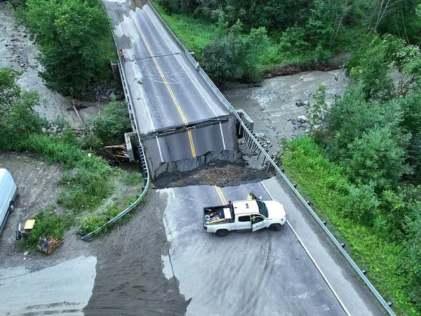
Photo by Vermont Center for Geographic Information, Attribution, from Wikimedia Commons
For more of the latest from the expansive government marketplace, check Government Market News daily for new stories, insights and profiles from public sector professionals. Check out our national contracting newsletter here.