

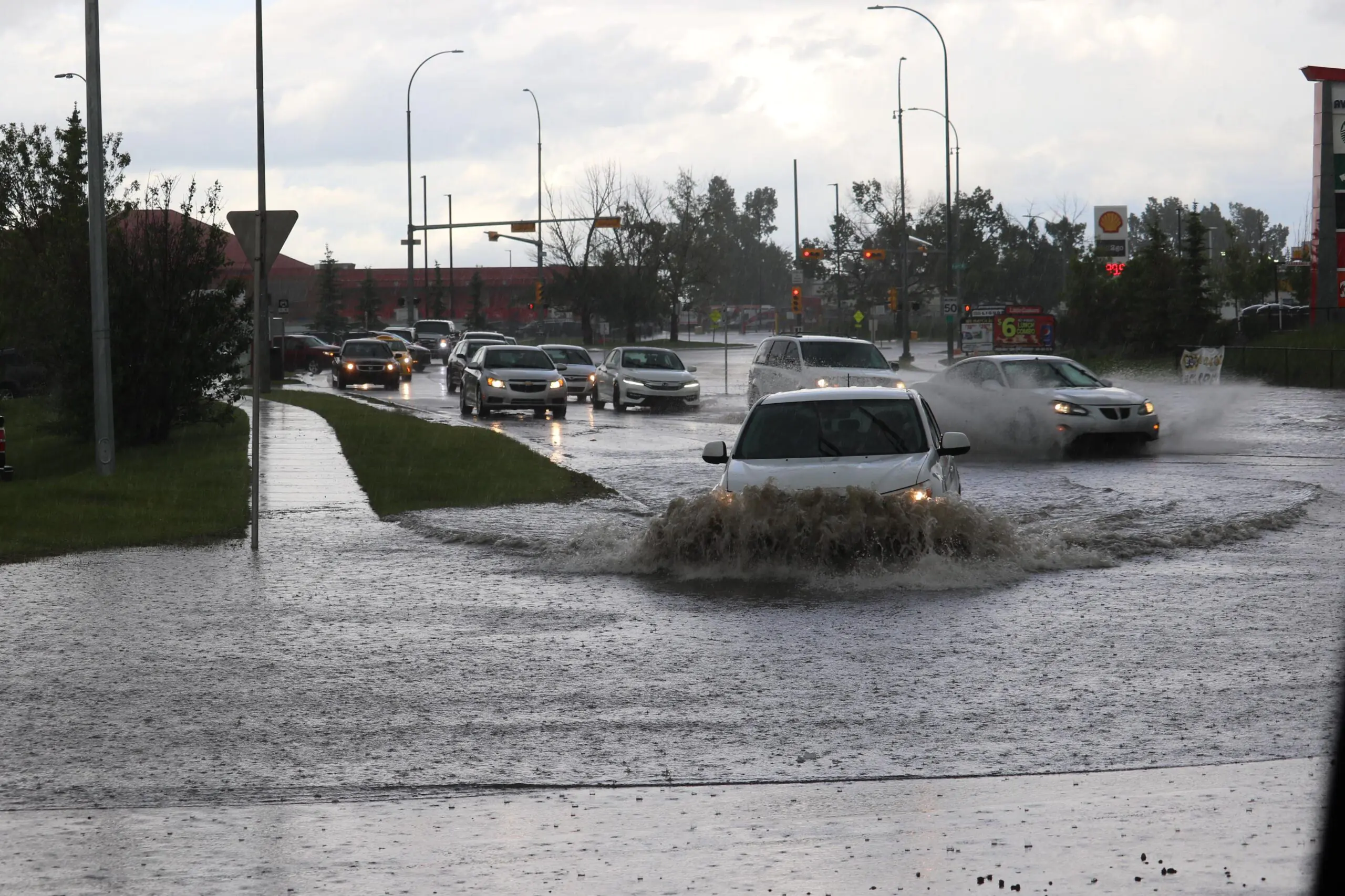
The city of Houston will allocate $131 million to enhance the conveyance capabilities of existing channels and develop a diversion channel in the downtown area. As flood risks escalate with worsening climate change and flash flooding seasons, project teams anticipate construction to begin in summer 2027.
Downtown Houston has been vulnerable to flooding for years, putting residential, commercial and essential infrastructure at prolonged risk of damage and destruction. The North Canal project will help lower the water surface elevation during flood events. By enhancing water conveyance during inclement weather, the downtown bayous will be able to handle more water, protecting public health and property.
The project vision calls for building a high flow channel designed to manage high water flows. Major components featured in the project will include an approximately 200-foot-wide channel. The channel will be supplemented by a 60-foot-wide wet pilot channel alongside concrete retaining walls and terracing.
Houston will install a paved maintenance and shared-use path along the channel’s edge and vegetated slopes to control erosion. In addition, the city will build a railroad bridge and a roadway bridge over the channel. Other plans involve making enhancements for trail connectivity, adjusting utilities, reconstructing nearby streets and grading for future pedestrian access.
Plans include installing vertical, anchored walls in the Yale-Heights area to increase the hydraulic cross section at the bridges. The city will need to remove an abandoned section of rail bridge to accommodate this work. Additional improvements include widening the channel to 16 feet, preserving trail connectivity on both ends of the site, building a maintenance access path and preserving the existing shared-use path.
The North Canal project will ultimately remove roughly 260 acres from the 50-year floodplain and 150 from the 100-year floodplain as part of the city’s long-term flood mitigation efforts. As a result, the canal will influence higher flows in the Buffalo Bayou downstream of the South Canal.
Image by Chris “CJ” Johnson from Pixabay
This story is a part of the weekly Texas Government Insider digital news publication. See more of the latest Texas government news here. For more national government news, check Government Market News daily for new stories, insights and profiles from public sector professionals.