


In the face of escalating climate threats — from intensifying storms and sea-level rise to extreme heat, flooding, and landslides — U.S. cities, counties and states are launching bold, multi-agency infrastructure efforts that blur the lines between governmental departmental divisions and jurisdictions. Gone are the days when water, transportation, energy, planning, and emergency management operated in isolation. Today’s resilience challenges and public safety risks call for unified strategies, shared governance, and joint funding.
In cities from San José to Alexandria, and in major corridors from South Florida to inland New Jersey, emerging initiatives are stitching together investments in mobility, drainage, public buildings, coastal barriers, and environmental restoration. The projects outlined below illustrate how government entities at all levels are increasingly electing to coordinate to preempt risks and build lasting community resilience. Many more upcoming projects such as these are currently in the planning stages throughout the country.
City leaders in San José, California will invest $40 million to upgrade community and transit facilities. The work will be designed to establish a citywide network of resilience hubs and upgraded transit stops to support citizens during climate-related emergencies.
The city’s Climate Ready Working Group (CRWG), a collaboration that includes energy, public works, and economic development departments, is charged with oversight of planning and designing this upcoming work. CRWG also works to expand San José’s existing climate programs with the objective of addressing risks from wildfires, flooding, sea level rise, and extreme heat. The group is responsible for prioritizing equity by directing resources toward neighborhoods most affected by climate impacts.
A part of the project will be to retrofit public facilities such as community centers, libraries, and recreation buildings so they can serve as resilience hubs capable of operating during emergencies. Planned improvements include installing backup power systems, upgrading HVAC and filtration equipment, adding electric vehicle charging stations, and expanding emergency supply storage. The upgrades will harden the public facilities against common climate hazards. The work will also include upgrades to transit facilities to support evacuation operations during emergencies. Existing facilities (transit stops, stations, and park-and-ride lots) will receive new shaded structures, heat-reducing roof treatments, and cool pavement installations. In times of short-term emergencies such as flooding, new elevated platforms will keep waiting areas dry and support more efficient evacuation efforts. When completed, the project will deliver a climate-resilient, connected network of transit facilities and resilience hubs equipped to protect citizens during climate-related emergencies. Construction work will likely begin in 2026, but no timelines have been announced.
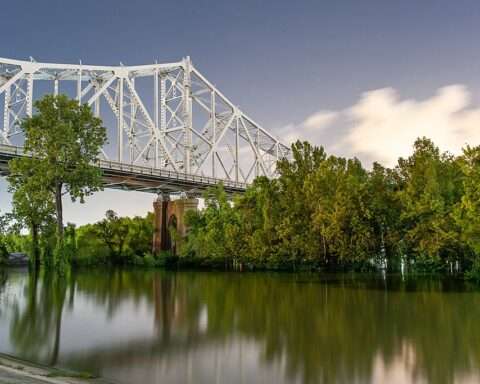
Officials of the South Florida Water Management District are advancing a $88.4 million basin resiliency project in Miami-Dade County. The objective is to reduce flooding risk and strengthen regional stormwater infrastructure. The project is outlined in the Florida Department of Environmental Protection’s Statewide Flooding and Sea Level Rise Resilience Plan. Officials produce the plan which is then used to guide budget recommendations and outline projects for implementation with state funding.
This initiative will include major upgrades to coastal structure which controls water levels in the C-9 canal. The canal regulates discharges to Biscayne Bay and provides flood protection for the surrounding area. Work will include construction of a new pump station and control building. It will also enhance the stormwater detention area at Pickwick Lake. Additional work will feature a tie-back flood barrier and a living shoreline along the C-9 Canal to restore natural hydrology and improve water quality.
Design, permitting, and bidding are scheduled through 2026, with construction expected to begin in late 2026 at the earliest.
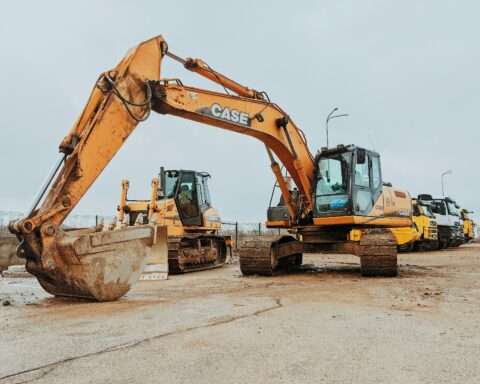
Officials at the New Jersey Department of Transportation have plans to launch an $82.35 million rockfall mitigation project along Interstate 80 Westbound in Warren County. The objective will be to enhance driver safety while making the roadway safer and more resilient. The work will call for the stabilization of steep rock outcrops and reduce the risk of falling debris onto the highway.
The project, outlined in the North Jersey Transportation Planning Authority’s Resilience Improvement Plan, will provide infrastructure upgrades that protect transportation corridors from geotechnical hazards and climate-related impacts. The planning document provides an assessment of vulnerable transportation assets recommended for immediate and long-range resilience projects.
The mitigation effort will encompass four locations. Planned improvements include controlled excavation and scaling to remove unstable rock. The work will also include installation of rock bolts and anchors to secure remaining slopes and placement of steel and wire mesh draping to intercept debris. New catch fences and roadside barriers will be installed to contain material that could dislodge during extreme weather or freeze-thaw cycles. When completed, the effort will deliver a safer, more resilient roadway for one of New Jersey’s most heavily used interstate segments. Environmental review and permitting are currently underway and construction could begin as early as late 2026.
In Alexandria, Virginia, city officials will oversee a $59.4 million project to stabilize and upgrade the Hooffs Run Culvert Bypass. The project will focuses on flood mitigation in the Hooffs Run/Timber Branch watershed. To increase capacity and decrease surface flooding, the construction of a new bypass culvert to divert Timber Branch water flows is required. The project will also include construction of a large-capacity storm sewer. Additionally, the selected contractor will be asked to assess water storage capacity and provide green infrastructure options to mitigate flash flooding, consider design alternatives, and provide cost-benefit estimates for different service levels. The design work will continue through 2025, and construction is slated for 2026. A phased delivery of the project is planned, and the city will create construction traffic maintenance plans during the design phase to preserve neighborhood access. This work may include traffic control signal equipment, limited lane closures, and off-peak work windows.
Acknowledging a trend where communities embrace a new era of climate resilience through integrated, cross-agency collaboration is exciting to see. It appears that a decisive shift toward unified planning and proactive investment is occurring. If it continues, it will transcend traditional departmental boundaries and surely result in all kinds of successful initiatives for safer, more sustainable, and adaptable communities.
Photo by Oregon Department of Transportation, CC BY 2.0 Generic https://creativecommons.org/licenses/by/2.0/deed.en, from Wikimedia Commons